Smeaton’s Tower Lighthouse, Plymouth
Here you can stand high above Plymouth and look out over Plymouth Hoe on a glorious sunny day. This aerial virtual tour was captured at the top of Smeaton’s Tower, Plymouth’s famous ex-lighthouse.
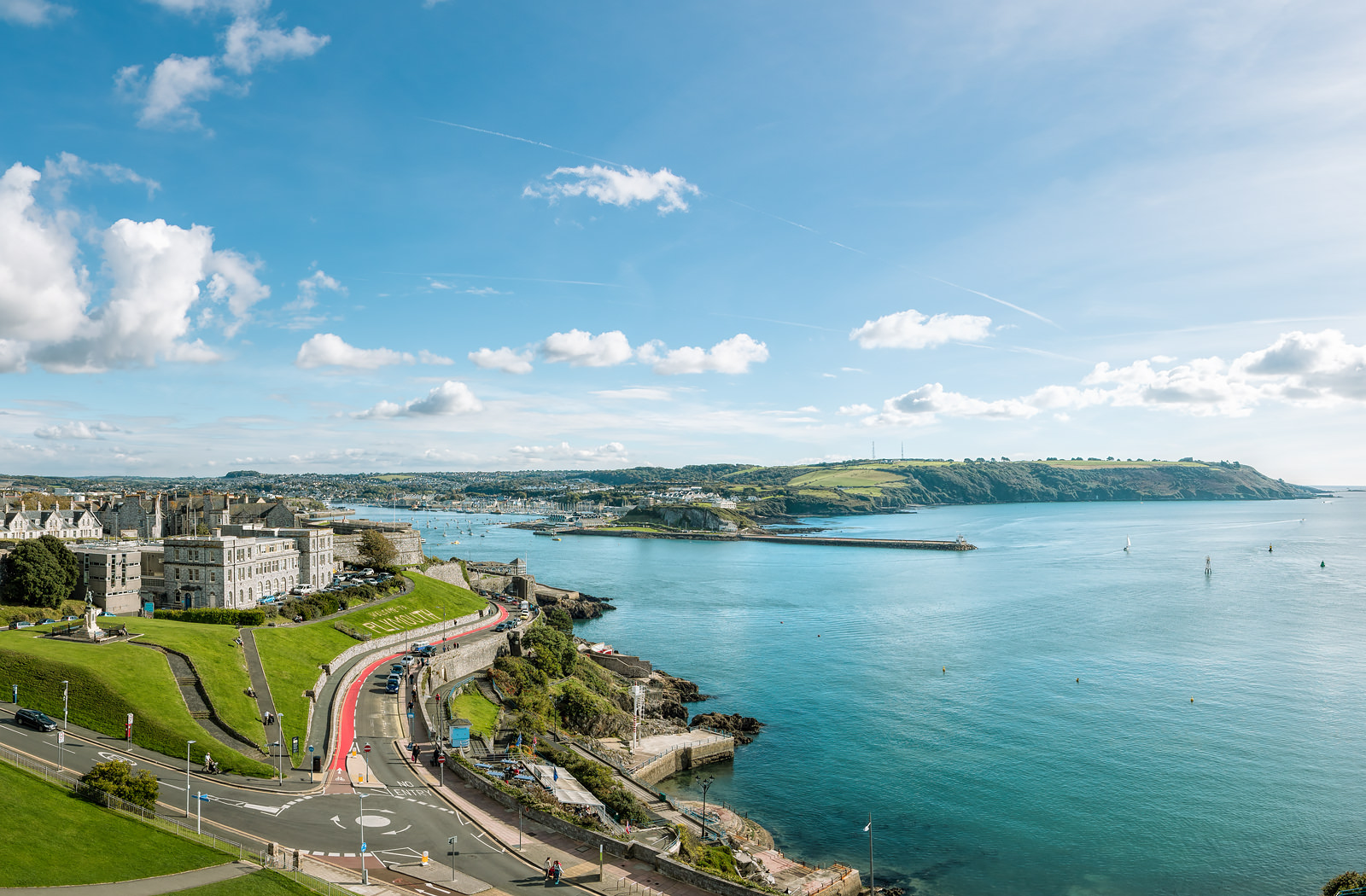
Smeaton’s Tower
Smeaton’s Tower was an 18th century lighthouse that was in use until 1877. Built by John Smeaton, it was eventually defeated by rock erosion. Rather than being demolished, the lighthouse was moved, brick by brick, to Plymouth Hoe where it looks out over Plymouth Sound. From the aerial 360 you can also see Tinside Pool. Tinside is the beautiful Art Deco lido that sits on the cliff above the Sound.
Aerial virtual tours
We’ve been venturing up high to shoot aerial virtual tours since the earliest days of 360s. This one is relatively tame at only around 93 steps to the summit (about 72 feet). At the other extreme, we’ve shot from the crane at the top of the Shard under construction – a height of 310 metres (over 1000 feet). Not for the faint hearted!
There are challenges in shooting 360s from heights, not least the safety of those on the ground. Every project is risk assessed and permissioned. On site we control access, secure kit and manage wind and vibration so the finished panorama is sharp and stable.
We often work in places where drones are restricted. In those cases we use approved vantage points, roof access, towers or masts to achieve safe, compliant aerial 360 photography with excellent results. The Smeaton’s Tower virtual tour was captured on the platform of the lighthouse, not from a drone.
Commissioning an aerial virtual tour
Tell us the view you want to show and any practical constraints. We will plan safe access, permissions and the best time of day for light and tide, then deliver a fast-loading 360 with your branding and optional labels for key landmarks. If you’re looking for an aerial virtual tour, you can be reassured that we are highly experienced in shooting from tall and awkward structures – whether from a platform with camera equipment, or from a drone in the air.
See more
Read more about our aerial services here, or get in touch for a quote.
Not always. Many elevated 360s are captured from towers, rooftops or masts when airspace is restricted or a drone isn’t appropriate.
Often, yes. We arrange location permissions and any required safety measures. For drone projects we also follow local regulations and weather limits.
Yes. We can add discreet hotspots or labels for navigation and points of interest. You might also be interested in seeing this London skyline example where the landmarks in view are labelled.
Page last updated: December 2025